“since some people had told me that I was ugly, I always preferred shade to the sun, darkness to light”
― Charles Bukowski, Ham on Rye
Shade structures on the Continental Avenue Bridge Park, Trinity River Bottoms
Dallas, Texas
“since some people had told me that I was ugly, I always preferred shade to the sun, darkness to light”
― Charles Bukowski, Ham on Rye
Shade structures on the Continental Avenue Bridge Park, Trinity River Bottoms
Dallas, Texas
Trinity River Bottoms
Dallas, Texas

(click to enlarge)
My Xootr Swift folding bicycle leaning against a railroad trestle in the Trinity River Bottoms, Dallas, Texas
There is a contrast between the forlorn forgotten floodplain muddy muddle given a little shade in the brutal Texas heat by a rusty rundown railroad trestle bereft of train, ties laddering the sky… and beyond the levee the glass crystal spires of giant office buildings bustling with city office workers invisibly moving in automated cubicles of air conditioned atmosphere.
The City of Dallas is slowly working on developing the long-neglected river bottoms along the Trinity River. In conjunction with the opening of the Continental Avenue Bridge Park a limited system of hike and bike trails were opened up in the river bottom called the Dallas Skyline Trail.
These trails will eventually be extended to the south to connect up with the Santa Fe Trestle trail once the work on the I45/I30 “Horseshoe” project is finished (if we all live long enough).
For the time being, the 4plus miles in place will have to do. I took the DART train down there to explore. The biggest problem right now is lack of access on the downtown (north) side of the river. I had to ride across the Continental bridge where there is a steep ramp down the levee into the floodplain and the trails. The limited (2) trail heads open now, with one more to open in a few months, is fine if the trail system is used for recreational riding, but if it is to help with car-free transportation, they need more access points.
I rode the whole system and wanted to check out another possible point – on Commerce street, behind the city jail complex. The trail climbs the levee and it may be another spot to get to the system – though it’s hard to find and there isn’t any parking very close.
At any rate, the view from there is nice – in all directions.

Part of the Dallas Skyline Trail. The Commerce Street Bridge, Old Railroad Trestle, Margaret Hunt Hill Bridge.
(click to enlarge)
The paved trail climbs the levee. That’s the Commerce Street bridge in the foreground, with graffiti on the pillars, a bit of the old railroad trestle, and the Margaret Hunt Hill Bridge in the distance.
The top of the levee is paved the short distance to Commerce Street behind the sad monoliths of the Dallas Jail and its parking garage.
In the other direction the trail is paved for a short way along the tip of the levee. Beyond is a gravel road which is rideable with a mountain bike.
The open floodplain of the river bottoms, across to Oak Cliff. The construction of the Horseshoe can be seen in the distance.
To the North, there is a great view of the downtown skyline from the top of the levee.

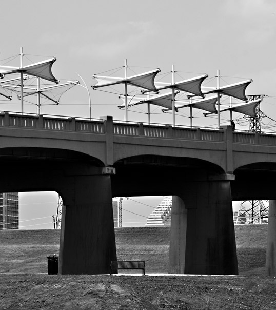
My Xootr Swift folding bike on the bike route over Interstate 10 in New Orleans. Downtown and the Superdome are in the background.
We had a trip to New Orleans planned for Tulane Graduation. Lee actually graduated in December, and didn’t plan on walking, but we wanted to go anyway… sort of a closure.
This was the first out of town trip that we had taken since I had bought my folding Xootr Swift bike. One of the reasons I wanted the folder was to be able to take it along, collapsed in the trunk, and pull it out for a ride whenever the opportunity presented itself.
Lee’s friends had arranged a party for the graduates and parents at Parkway Bakery and Tavern. A few years ago I had seen a television show that claimed Parkway had the best Shrimp Po’ Boy sandwiches in New Orleans. That’s a pretty salty claim – but I have eaten there before and can’t really argue (though Domilise’s is close). No way am I going to miss a meal at Parkway, and I wanted to ride my bike. As early as I could rustle my rusty bones out of our guesthouse in the Garden District I walked to the car, unfolded my Xootr from the trunk, and set out across the city.
I had no real idea of a where I was going, but used my phone and the Bicycle Route little green lines on Google Maps and was able to find my way. One good thing is the way the Crescent City is laid out, as confusing as it can be, all the roads seem to run to Parkway’s ‘hood.
I have been going to New Orleans for decades, and I think this was the first day of really, really nice weather I’ve ever seen. I had ridden my commuter bike around Tulane in December, but the wind was howling cold spitting rain.
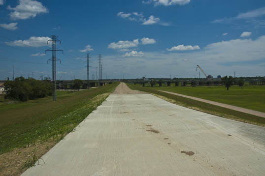
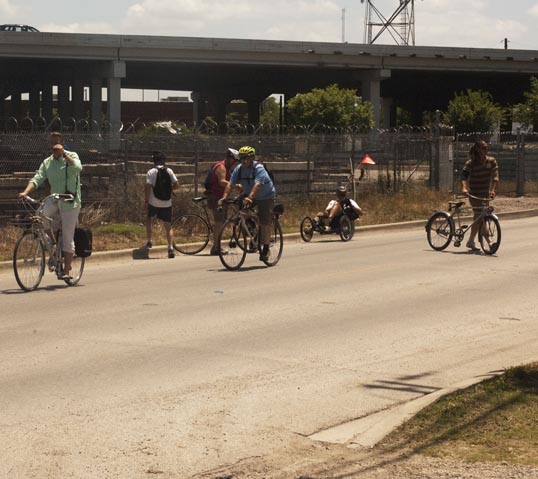
New Orleans has been working hard on making its streets more bike friendly and they have succeeded. There are bike lanes and recommended streets. There aren’t a lot of dedicated trails, except in a few key choke points – like crossing Interstate 10.
There is no comparison to Dallas (which is well known as the worst city for cycling). First, let’s face it, the city of New Orleans itself isn’t really very big – it’s only four miles or so from the river to Lake Pontchartrain – as opposed to the hundred miles from Mesquite to Benbrook.
New Orleans is hell to drive in – which, ironically, makes it easy to ride a bike in. The streets are narrow and choked which slows and “calms” the traffic. I could ride across town as fast as I can drive. In Dallas it’s not unusual to come across cars going a mile a minute – which is rolling death if you aren’t wrapped in a steel carapace.
The one downside to riding there are the cracked pavement and the potholes. I had to keep my eyes open and those tiny wheels on the folder transmit every shock right to my spine. I learned quickly to stay off the side streets and use the lanes on the larger thoroughfares – the pavement had been better repaired.
But, other than that – it was a blast.
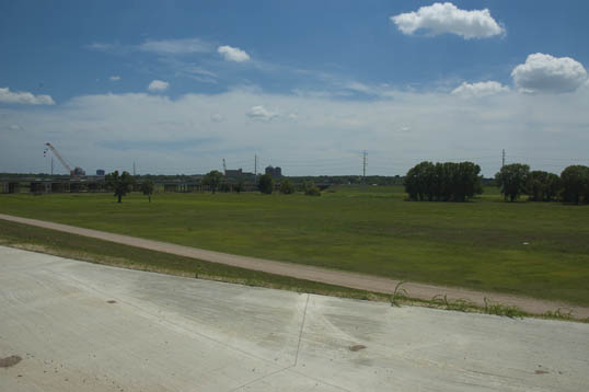
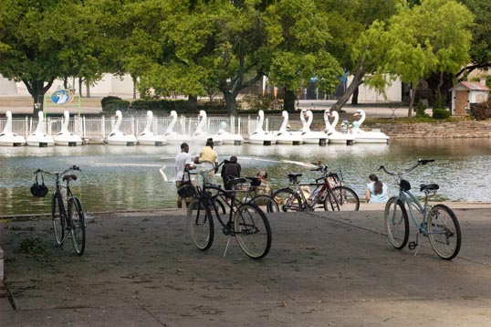
I became lost less often than I had predicted (only once) and arrived at Parkway an hour early. That gave me time for a quick ride around City Park and along the shore of Lake Pontchartrain. City Park is beautiful and huge (though people tell me it is a shadow of its pre-Katrina glory) and Pontchartrain feels like an ocean shore.

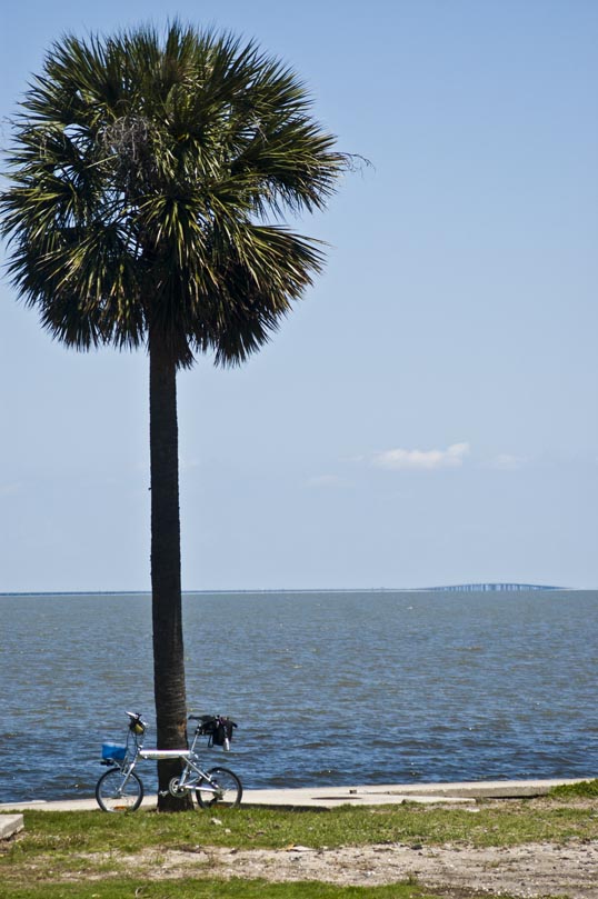
My Xootr Swift along the shore Lake Pontchartrain, New Orlean, Louisiana. You can see the Pontchartrain causeway on the horizon.
I didn’t have time to waste so I kept pedaling and still made it to Parkway before the festivities. I locked the bike out front until Candy and Lee arrived in the car – then all I had to do was fold it back up into the trunk.
Another advantage of the ride – that Shrimp Po’-Boy sure tasted extra good.
One of the riders on the Stop and Photograph the Roses bike ride met up with us about halfway through. He was delayed because he was picking up a “new” bicycle.
It was a 1936 Monark Silverking and it was way cool. Made of cast aluminum and swaged tubing it was a long way ahead of its time. I didn’t know that there were pre WWII aluminum bicycles.
We posed it in front of the Art Deco sculptures in Fair Park. I realized that the bike was made in the same year as the architecture. It shows.
A while back I went on a fun, educational, and very cool bike ride that explored some murals in the Design District and West Dallas that had been commissioned by the Dallas Contemporary gallery. At the time, they had a new project going, Inside Out – The People’s Art Project, where they set up a series of photo booths and had people come by to get their photo done. These were then printed bigger than life size and put up at various locations around the city.
I wanted to participate in it, but never was able to put it together – when I could get down to a booth and get my photo shot. I should have tried harder, but time slips.
Anyway, last weekend, on our Stop and Photograph the Roses bike ride, we ran across one of the Inside Out installations. It’s been up a while and it getting long in the tooth, the paper tearing and falling off the wall, the photos fading, time is taking its toll.
Somehow, I liked it even better that way.
Photo taken during the Stop and Photograph the Roses bicycle ride.
I had seen the Dallas Eye Before – but have never been able to stop close by it in the daytime. We rode our bikes from the Arts District down to the little side-street Stone Place – a little known oasis in downtown. A long time favorite spot of mine – I remember it from when I first moved here. It, like everything else, has been up and down many times since then.
Unfortunately, we could not cross the iron fence that surrounds the orb. I guess they are afraid that if the uncontrolled public were allowed in, the unwashed masses, things might get out of control and someone might get poked in the eye.
Photo taken during the Stop and Photograph the Roses bicycle ride.
Magnolia Hotel Building (Pegasus) and Joule Hotel (pool)
Dallas, Texas
A while back, Chris of Biking in Dallas contacted me to help set up a bicycle ride. He and Amanda of Dallas Cycle Style had the idea of a slow bike ride dedicated to photography.
The idea is that on so many bike rides you see something that you want to stop and look at – or take a photograph of – but the ride goes on. We wanted to do a ride that was purposefully slow, more or less dedicated to photography, and that would go and stop whenever the fancy took us. The ride was called Stop and Photograph the Roses.
I took on the task of designing the route. We wanted to start in the Dallas Arts District, visit downtown and some photogenic spots in the area. My first routes were too long with too many stops. Thinking about it, there were simply too many places that I thought people would want to see and take pictures of.
So I whittled it down. And whittled it down some more. And finally took a last couple out. Out were Klyde Warren Park, the original Belo Park, the Bowler Hat and the rest of the Cedars….
What was left was a route that started at One Main Place, went through the Arts District, then on to the new Belo Garden Park by way of the Dallas Eye. Then Commerce Street to The Farmer’s Market – with a stop there for rest and lunch. Finally, a short ride past some favorite murals of mine to Fair Park and then a return through Deep Ellum.
We had a surprisingly good turnout – maybe thirty folks. As the day went along, it began to get hot and we lost some folks along the route – there is so much going on this time of year, but more than a handful stuck it out the whole way.
I think everyone had a good time. It will be cool to see the photos that everybody else took as they filter across the internet. The one disadvantage of planning the route is that I was familiar with almost everything along the way – and already have taken (and placed on this blog) shots of most of what we saw.
Still, that let me enjoy the ride more than the photography – and I still collected enough for a few blog entries to fill in some upcoming days.
And now I think of the places we didn’t go. Maybe we can do another….

Stopping to look at a mural along Hickory Street. This is a part of the city most folks don’t visit.
A Facebook Video from Andrew Pearson – an interview with Chris Curnutt on how the ride came about.