Locked in What Cage

“Insanity is relative. It depends on who has who locked in what cage.”
― Ray Bradbury

Unnamed Sculpture
Ed Carpenter, Richardson, Texas

Unnamed Sculpture
Ed Carpenter, Richardson, Texas

Workers installing glass bits,
Unnamed Sculpture
Ed Carpenter, Richardson, Texas

Richardson, where I live, has an ambitious trail that bifurcates the city from North to South roughly along Highway 75 and the DART Red line – the Central Trail. However, one key spot near the north end of the trail has been pretty much useless for over a year due to all the construction at Alma and Greenville. Now all of that is headed into the home stretch (until something new pops up) and now, something really new is growing up out of the ground.

At first, most folks assumed it was a cell phone tower or other piece of infrastructure – but it actually is a huge work of art.

From the city’s description:
An iconic art piece celebrating the history of the technology in Richardson will be installed late this summer just south of the Eastside development. The site at Greenville and Alma was specifically selected for a unique public art opportunity since it is a highly visible location, located at the center of the community and Telecom Corridor® area and is in close proximity to the Central Trail for pedestrians to enjoy. This public art installation corresponds to the goals set for the City’s Public Art Master Plan adopted in 2015.

….

The art piece features a lattice of crossing diagonal stainless steel cables on a galvanized carbon steel main structure supporting laminated dichroic glass elements. The glass elements suggest abstract ones and zeros, the basic building blocks of all things digital, which the artist and committee felt was fitting for a city with a high-tech identity.

At first, I thought it looked like a giant frisbee golf goal. Now, I realize it looks more like the world’s largest set of tomato cages.

An now the vines are starting to climb up. Workers are out on a lift in the late summer stifling heat installing strings of colorful glass over the armature. I have no idea how much they will hang up – what it will look like when it is finished. At that point they will put in some landscaping (hopefully, a nice rest stop with some benches, shade, and water along the Central Trail). Eventually, all will be revealed, including the sculpture’s name.

We’ll see – if you are interested, stay tuned.

Walking Along the Levee

“One who knows the Mississippi will promptly aver—not aloud, but to himself—that ten thousand River Commissions, with the mines of the world at their back, cannot tame that lawless stream, cannot curb it or confine it, cannot say to it, Go here, or Go there, and make it obey; cannot save a shore which it has sentenced; cannot bar its path with an obstruction which it will not tear down, dance over, and laugh at.”
― Mark Twain, Life on the Mississippi

Walking on the levee
New Orleans

A Hot Day at the Audubon Center

I have been to the Trinity River Audubon Center once before – when I rode my bike there to visit Ruben Ochoa’s sculpture Flock in Space. It had been installed there as part of the Nasher Xchange sculpture series. I rode my bike across the city, visiting all ten and writing about it.

This morning I took a look at the internet, looking for something to do and came across a listing that pointed out that admission to the Audubon Center is only a buck in July and August. This might seem a little odd to someone not from here – why would admission to an outdoor center be reduced during the height of the summer? It is, of course, because the summer is flooded with toxic heat.

So I drove down there as close to opening in the morning as I could manage and it wasn’t too bad. At least not for a few minutes. I paid my dollar (an put some more in the donation bucket) and started walking the trails. They advised to check out the wetland and prairie trails first and then visit the shady wooded section – as the day warmed up.

It warmed up fast – the temperature climbed to over the century mark within a couple hours. I did carry my insulated growler full of iced water and that helped a lot.

The Center has a few miles of trails and I was able to walk them all. Even though it was hot and dry (most of the wetlands were more like mudlands) I enjoyed the variety of the geography – swampy, open areas, and thick woods. The Center is built on a recovered landfill and that gives it an array of terrain you don’t see in such a small place in North Texas.

I didn’t take to many photographs, but I had a good time and want to go back soon.

Especially when it isn’t so hot.

I think this is an American  White Ibis

I think this is an American White Ibis

Trinity River Audubon Center

Trinity River Audubon Center

View From the Levee

The City of Dallas is slowly working on developing the long-neglected river bottoms along the Trinity River. In conjunction with the opening of the Continental Avenue Bridge Park a limited system of hike and bike trails were opened up in the river bottom called the Dallas Skyline Trail.

Map of the Dallas Skyline Trail

Map of the Dallas Skyline Trail
(click to enlarge)

These trails will eventually be extended to the south to connect up with the Santa Fe Trestle trail once the work on the I45/I30 “Horseshoe” project is finished (if we all live long enough).

For the time being, the 4plus miles in place will have to do. I took the DART train down there to explore. The biggest problem right now is lack of access on the downtown (north) side of the river. I had to ride across the Continental bridge where there is a steep ramp down the levee into the floodplain and the trails. The limited (2) trail heads open now, with one more to open in a few months, is fine if the trail system is used for recreational riding, but if it is to help with car-free transportation, they need more access points.

I rode the whole system and wanted to check out another possible point – on Commerce street, behind the city jail complex. The trail climbs the levee and it may be another spot to get to the system – though it’s hard to find and there isn’t any parking very close.

At any rate, the view from there is nice – in all directions.

Part of the Dallas Skyline Trail. The Commerce Street Bridge, Old Railroad Trestle, Margaret Hunt Hill Bridge.  (click to enlarge)

Part of the Dallas Skyline Trail. The Commerce Street Bridge, Old Railroad Trestle, Margaret Hunt Hill Bridge.
(click to enlarge)

The paved trail climbs the levee. That’s the Commerce Street bridge in the foreground, with graffiti on the pillars, a bit of the old railroad trestle, and the Margaret Hunt Hill Bridge in the distance.

Top of the levee, with the Dallas Jail in the background.

Top of the levee, with the Dallas Jail in the background.

The top of the levee is paved the short distance to Commerce Street behind the sad monoliths of the Dallas Jail and its parking garage.

Dallas Skyline Trail on top of the levee.

Dallas Skyline Trail on top of the levee.

In the other direction the trail is paved for a short way along the tip of the levee. Beyond is a gravel road which is rideable with a mountain bike.

Trinity River Floodplain

Trinity River Floodplain

The open floodplain of the river bottoms, across to Oak Cliff. The construction of the Horseshoe can be seen in the distance.

Nice levee top view of Downtown from the Dallas Skyline Trail.  (click to enlarge)

Nice levee top view of Downtown from the Dallas Skyline Trail.
(click to enlarge)

To the North, there is a great view of the downtown skyline from the top of the levee.

Two Years and a Ride to Denton

I’ve now had this WordPress blog up for two years. I jumped in after a friend of mine, Peggy, started hers.

Of course, I’ve done this before… As best as I can tell, back in the 1990s I was somewhere around the thirteenth blogger on the internet – though this was years before the term “blog” was coined. We called them “online journals” or a “digital diary.” I started writing web pages using notepad and posting them in the five megabytes or so that America Online used to give you. I outgrew that and bought a URL and some web space (from what turned out to be the world’s worst online service provider). For well over a decade I wrote something every day. I had to quit when my kids reached high school and too many people I knew in “real life” started reading the thing. Actually, I didn’t quit – I simply went to paper.

Now, this time around… it’s completely different. I don’t write as much in it (my writing addiction is mostly served by fiction now) and do too much photography. But it is what it is.
Two Years
773 posts
2,667 comments
Days missed – none.

At any rate…

A few weeks ago, Candy and I went up to Denton for the Arts and Jazz festival. The last time we went, a couple years ago, it was way too crowded and we had a tough time parking… so this time, we decided to go earlier and to ride the Denton County Transit Authority A-Train up to Denton. This was a great idea – the train ride was fun and the festival was cool – we headed back before the crowds really began to build.

Denton is a cool city. To a big extent, it is a college town, almost like Austin-lite. I enjoyed the pedestrian and bike-friendly areas around the town square and decided I wanted to go back there with my bicycle.

Looking at Google Maps, I noticed the telltale green line that represented a hike-bike trail that ran from Lake Dallas through Corinth up to Denton – a little more than eight miles. It paralleled the A-Train tracks and I was able to get a good look at it from the train windows. It’s called the Denton Katy Trail – and it looked like a nice bike ride.

So, one Sunday that promised nice weather (and light winds) I decided to pack my camera, drive to Lake Dallas with my road bike and head up the trail to Denton. There, I would wander around a bit, take some photos, and then ride back down.

The start of the Denton Katy trail off of Swisher Road, in Lake Dallas.

The start of the Denton Katy trail off of Swisher Road, in Lake Dallas.

The trail was nice – really nice. There is a great feeling of booking along fresh, smooth, level concrete. Not very many people using it – a few walkers from the suburban neighborhoods… I only saw one or two other bicycles. Still, it was fun and an enjoyable ride. Until…

The trail ended.

The sudden end of the Denton Katy Trail

The sudden end of the Denton Katy Trail

Along the south side of Denton is a loop expressway, the 288 and the trail stopped there. They are building a big new pedestrian bridge over the expressway, and it looks finished… but isn’t.

Now, I know that the bridge is expensive and is being built with the best of intentions. That highway is a barrier – though not an insurmountable one. They do have several intersections with lights – you can cross easily if you wait for a green. Once the bridge is finished, bicyclists and walkers can bypass the highway, walking up and over.

The pedestrian/bicycle bridge over 288 in Denton. It will be nice when it is finished.

The pedestrian/bicycle bridge over 288 in Denton. It will be nice when it is finished.

And that’s the problem. In separating the bike/pedestrians from the city, you make the trail into a recreational opportunity and take away the integration of human-powered transportation with the life of the city.

Presented with the closed trail, I considered turning around and heading back, but I wanted to get to downtown Denton. I walked my bike through a bit of thick woods lined with empty wine bottles and found myself in back of a huge Big-Box store of some kind. That area all along 288 is a massive expanse of auto-oriented shopping hell, with every chain store imaginable. No sidewalks, no way through, acres and acres of tarmac covered with clouds of exhaust fumes. Not a fun place to fight through on a bicycle.

This is what I am talking about. They can spend millions on a bridge to bypass the life below, but can't finish the sidewalks. Areas like this are openly hostile to people without cars.

This is what I am talking about. They can spend millions on a bridge to bypass the life below, but can’t finish the sidewalks. Areas like this are openly hostile to people without cars.

The ironic thing is that there were other people trying to walk through there. You would never see them from a car – but they are there… homeless people, young teenagers, poor students – the shadow population, carless by choice or by situation.

Again, I salute the money and effort put into the trail and that impressive bridge, but fear that the people behind this effort don’t understand the idea of making a city where you don’t have to have a car. I don’t think they can even imagine such a thing.

I was able to work my way through the maze of parking lots and fight past the thick streams of tinted-window SUVs and pickups to finally make my way into the old-fashioned heart of Denton… the area around the square and the roads leading out to the universities. There the cars, walkers, and bikes live together, moving a little more slowly, but getting where they need in plenty of time. It’s funny, the part of the city with the most modern, hip lifestyle… the part that everyone is spending millions of dollars trying to emulate… is the oldest, most “outdated” style of a city square surrounded by narrow streets with limited parking.

That’s the part I like.

Bicycle Route on the Viaduct

Trying to integrate bicycling into daily life – using a bike as transportation rather than a child’s toy – here in Dallas, the worst city in the country for cycling, I have become very sensitive to the barriers that cross potential cycling routes. Barriers… that leave chokepoints. All the trails in the world are merely outside exercise paths if they don’t have a way through the barriers. Barriers like highways, or railroads, or worst of all, rivers.

The Trinity River, as rivers go, isn’t much to write home about. In dry weather it’s not much more than a muddy green strip of particularly wet swamp. However, as a barrier, it’s more than river enough. Until recently, there has been no safe way to get across this riverbottom no-man’s land.

The City constructed a trail over an old railroad trestle (next to a failed attempt at a whitewater canoe feature) but they neglected to connect it to anything and it is useless for transportation. There are grand plans for the future, but I’ll believe those when I see it.

But now, there is something… something pretty good. There has always been twin roads over the Trinity, connecting downtown with Oak Cliff – the Houston and Jefferson viaducts. Built at different times, with different designs, they have been twinned, with one going in and the other going out.

Money has been found and now, the Houston Viaduct has been closed for construction of a Streetcar Line that will run from the Convention Center in Downtown across the river and over to the edge of the Bishop Arts District. In the meantime, both in and out traffic has been routed over the Jefferson Viaduct.

And, wonder of wonders, one lane has been blocked off and marked out for bicycle traffic, one lane going each way. There is now a safe and reliable route from Oak Cliff into downtown on a bicycle.

Bicycle Lanes on the Jefferson Viaduct from Oak Cliff into downtown, Dallas.

Bicycle Lanes on the Jefferson Viaduct from Oak Cliff into downtown, Dallas.

It’s been there for a few weeks now, but I haven’t had a chance to ride it until Sunday. I took the DART train down to the Convention Center with my commuter bike hanging from a hook in the middle car. A little girl in a stroller stared at me, sitting there holding my bike’s rear tire to keep it from swaying with the train’s motion, wearing a helmet and sunglasses, the entire way. Meanwhile, a con man with a little shell game monte played with tiny red plastic cups on a newspaper folded across his knees relieved her mother and a friend of a quick ten bucks.

I left the train in the parking garage under the Convention Center and wound my way up into the daylight by the new Omni Hotel, then looping around to the viaduct. I rode across, visited a little gateway park, then came back, pausing to take a few photographs here and there.

The bike route was nice – the bridge had a bit of a hill to it, but nothing too difficult. The views in all directions are pretty spectacular – you never notice how impressive when you are in a car.

The only downside is that the approaches to the bike lanes are very awkward on both ends. Since this is a converted one-way bridge, with both bike lanes on one side – there is no good way to get cars and bikes on and off without a lot of confusing and difficult signage and odd routing.

One odd thing is that there is an old deserted parking garage in the middle of the span. It had been built to service long-gone Reunion Arena and it now sits abandoned – acres of bare concrete and sweeping ramps. Surely something useful (maybe a rooftop park?) could be done with this monstrosity.

I didn’t spend too much time – I was meeting Candy for lunch at Lee Harvey’s in Southside and then I had about twenty five miles to get home. That’s a long way on the heavy, inefficient commuter bike… but the day was nice and I was in no hurry.

Flats

I have been looking for new places to go for a bike ride – and willing to drive farther from home. With the seats folded down, my bike fits in the back of the Matrix and it gets nice gas mileage – so it’s all good.

Looking over Google Maps with the “Bicycling” option turned on, I spotted a green line going north from Highway 380, just east of Denton. It’s the 380 Greenway/Ray Roberts Greenbelt trail and runs ten miles north through the riperian forest of the Elm Fork of the Trinity River, ending up at the dam of Lake Ray Roberts.

So, after wasting the morning futsing and dutsing around the house, I loaded up my stuff and drove north through the big evil city until I reached the parking lot off of Highway 380. The Greenway trail is a branch of the Texas State Park system, so I had to pay to use it, sealing seven dollars into a little envelope and dropping it in a steel box. I checked all my gear out, saddled up and headed north into the woods.

The trail is flat as a pancake for the whole distance, which makes it easy and fast, though you never stop pedaling. The trail splits in two – with the equestrian trail on one side of the river and the hike/bike on the other. There were a few folks walking near the south end, but after a couple miles I only saw the occasional mountain bike. The southern section is locked in heavy woods – which is really nice, anything to shade the blazing Texas sun. As it goes north, the landscape opens out a little, with the occasional hayfield or open meadow breaking up the scenery.

It was a really nice ride through some bucolic scenery, but I made a tactical error. I didn’t read closely enough before I left and didn’t think about the trail surface. It is an improved hardpack with gravel surface. I left my thin, smooth, street tires on the bike. They are wide enough, so I didn’t have any problem riding – but the stones cut them to pieces.

I was no more than a couple miles up the trail when I stopped to take a photo of the trail through the woods. When I started back up my bike tire was flat. I carried an extra tube and a patch kit, so I sat along the trail and swapped the tube out. I couldn’t find a thorn or anything, but did find a small hole and patched it, keeping that tube as a spare.

Six miles up the trail, it crosses a highway and I stopped there for a protein bar and some water, and my tire went flat again. Out with the tire levers, off with the tire, on with another patch. This time I did find a tiny glass sliver – took it out. Since this was my second flat, I thought about heading back south to my car, but I sat there for twenty minutes and it seemed to be holding, so I went north to ride the whole trail.

I stopped again at the base of the Ray Roberts dam to rest for a bit. A big, expensive SUV drove up and a couple climbed out. They walked up to me and the driver, in a thick New Jersey accent, asked me, “Do you live around here?”

“Umm, I live a long way from here, but maybe I can answer your questions.”

“Well, we’re looking at a house near here and I wanted to see about this park. It says you have to pay to park here.”

“Oh, if you lived close, you could buy an annual pass. It’s about fifty bucks, I think. You could use this trail and the Ray Roberts park has a nice beach and a lot of stuff to do.”

We talked a bit about the trail (he had looked at it on Google Maps) and where it went and how it connected to the park. The two of them walked around and looked at stuff. I wished them good luck on their house hunting and they drove off. I packed up and headed back down the trail.

A few miles down the trail I felt my back wheel hit a rock hard and immediately the tire went flat again.

This time I found three holes in the tube, patched them, and pumped it up. I counted my patches, three left, plus one spare patched tube, so I was pretty sure I could make it back to my car, but I was getting tired of working on those flats, and my arms were sore from pumping up those fat tires with the little portable pump.

I was able to hammer on down the trail without any more trouble though. As I neared the southern end more walkers began to appear – the day was getting long and the temperature was cooling off.

I went past a woman walking along wearing an outrageous frilly bright red dress, thick makeup, and high heeled shoes that were completely useless on the gravel trail. She looked sheepish, stumbling along, and next to her was a man carrying a tall, transparent, lucite chair. I certainly hope the two of them were walking to do a photo shoot in the woods – otherwise… well, I don’t know.

It was nice to see my car in the parking lot while I still had some air in my tires.

The trail runs through thick forest near the south end. While I was taking this photo – my tire was losing air.

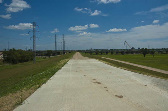
A nice rest spot near the north end of the trail.

Ruins of an old bridge near where I took the photo above.

Under the old bridge – the Elm Fork of the Trinity is surprisingly clear and pleasant.

The northern terminus of the trail below the Lake Ray Roberts dam.

Arbor Hills and Carrollton Blue and Orange

The overlook at Arbor Hills Nature Preserve in Plano, Texas.

Slowly, I am able to ride farther and farther on my bike. I’m still slow – I am riding an old, inefficient mountain bike (which does have the advantage of being able to go anywhere). I have my ancient road bike which I’m trying to get into rideable condition… but I am struggling with mystery flats. When it is fixed I should be able to up my speed and distance. Right now I am limited not so much by my fitness but by time and the amount of water I can carry. I drink an amazing amount of water in this heat.

What I like to do on weekends sometime is to load up my bike in the back of the Matrix, fill a cooler with bottles of iced water, and set out across the city. I use GoogleMaps on my phone, with the Bicycling option turned on – showing up the bike trails and dedicated lanes bright green. I look for long stretches or connected clusters and give a shot at riding somewhere I haven’t been before.

On Sunday, I headed northwest and the first place I came across was the Arbor Hills Nature Preserve. This is a large Plano park which I had seen a couple years ago when I made a wrong turn leaving the hospital where Candy was getting surgery. It had an odd parking lot, beige rock buildings, and a big ol’ mess of hilly woods. I looked it up online and had wanted to pay a visit ever since.

It was an interesting place to ride a bicycle. First – it does lack distance – only a couple miles of paved trails (I wasn’t in the mood for hitting the dirt). It isn’t a very good place for speed either – the trails are lousy with clots of people wandering around and others walking their dogs.

What is nice, though, is its hills. There are a lot of wooded nature trails in the Dallas area, but almost all of them are located in worthless river bottom floodplain and are as flat as a pancake. Arbor Hills has a good bit of ups and downs – not enough to make it too difficult or even unpleasant, but enough for a good workout.

The trails all wind around and rise up to a stone lookout, a nice destination, a pretty place looking out over the trees and scrub fields with only a hint of the millions of rooftops rising along the horizon – a reminder of the fact that you are not really in a wilderness, but merely a forgotten pocket of vegetation left over somehow when the world was paved over.

I looped around a couple of times, then packed my bike up and drove on. I wanted to go down to Carrollton and check out their trails. I had read about how they had been doing a lot of work on extending their hike/bike trail network. I did a circuit of their Orange and Blue trail routes, about ten miles total.

I applaud their work, and some of their trails are nice… running beside some swampy ponds and wild green creeks. They need to do more to access the network, though. It was fine for some exercise, but the pavement doesn’t really go anywhere – it would not work for commuting to work or shopping.

Sitting at a little shaded bench I gulped down my last bottle of cold water and knew it was time to head back to the car and go home. There is always tomorrow, and more stretches of pavement in a different direction.

Neighborhood Upgrade

One of my favorite bike trails in Dallas is the Santa Fe Trail, which runs from the south end of White Rock Lake (it connects with the trail around the lake) down an old railroad right of way, ending in Deep Ellum. I rode it the other day and turned the other way – going under Interstate 30 and riding around in Fair Park.

What I like about the trail is that it is a rare urban trail. The northern end starts in the woods around White Rock Creek but the trail soon emerges into a bustling lower-income city neighborhood. It makes for interesting riding.
I have noticed that a lot of the houses along the route, some little more than shotgun shacks, have been upgraded since the trail opened. There is a lot of fresh paint and large piles of trash along the streets waiting to be hauled away. I don’t know if it is because the residents feel that they are now more exposed and want to put a better foot forward, or, more likely, the trail raised property values a bit and the landlords are cleaning up to get higher rents.

At any rate, one property does have an unusual sculptural addition along the rear roofline. There is a four-person bicycle mounted along the edge of what used to be an awning – the roof long rotted away. A satellite dish sprouts out from next to the rear-most tire. It looks pretty odd, sitting there – sort of a shout-out to the cyclists on the trail – “hey, look at me… a quadruple… and you thought you were something!”

But it looks pretty cool, anyway.

I like the different patterns in the chainrings.