The City of Dallas is slowly working on developing the long-neglected river bottoms along the Trinity River. In conjunction with the opening of the Continental Avenue Bridge Park a limited system of hike and bike trails were opened up in the river bottom called the Dallas Skyline Trail.

Map of the Dallas Skyline Trail
(click to enlarge)
These trails will eventually be extended to the south to connect up with the Santa Fe Trestle trail once the work on the I45/I30 “Horseshoe” project is finished (if we all live long enough).
For the time being, the 4plus miles in place will have to do. I took the DART train down there to explore. The biggest problem right now is lack of access on the downtown (north) side of the river. I had to ride across the Continental bridge where there is a steep ramp down the levee into the floodplain and the trails. The limited (2) trail heads open now, with one more to open in a few months, is fine if the trail system is used for recreational riding, but if it is to help with car-free transportation, they need more access points.
I rode the whole system and wanted to check out another possible point – on Commerce street, behind the city jail complex. The trail climbs the levee and it may be another spot to get to the system – though it’s hard to find and there isn’t any parking very close.
At any rate, the view from there is nice – in all directions.

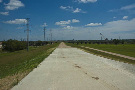
Part of the Dallas Skyline Trail. The Commerce Street Bridge, Old Railroad Trestle, Margaret Hunt Hill Bridge.
(click to enlarge)
The paved trail climbs the levee. That’s the Commerce Street bridge in the foreground, with graffiti on the pillars, a bit of the old railroad trestle, and the Margaret Hunt Hill Bridge in the distance.

Top of the levee, with the Dallas Jail in the background.
The top of the levee is paved the short distance to Commerce Street behind the sad monoliths of the Dallas Jail and its parking garage.
Dallas Skyline Trail on top of the levee.
In the other direction the trail is paved for a short way along the tip of the levee. Beyond is a gravel road which is rideable with a mountain bike.
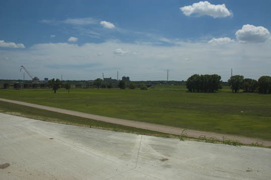
Trinity River Floodplain
The open floodplain of the river bottoms, across to Oak Cliff. The construction of the Horseshoe can be seen in the distance.

Nice levee top view of Downtown from the Dallas Skyline Trail.
(click to enlarge)
To the North, there is a great view of the downtown skyline from the top of the levee.

Levee. 🙂
oops.
Reblogged this on Bicycle Trax and commented:
Dallas’ Trinity Skyline Trail
They are making great strides in Dallas through a network system.
Pingback: Pillar 6N | Bill Chance
Pingback: Pillar 8N | Bill Chance
Pingback: Under the Bridge | Bill Chance
Pingback: Let’s Talk of Graves, of Worms, and Epitaphs | Bill Chance
Pingback: Unappeased Yearning To Return. | Bill Chance
Pingback: What I learned this week, January 9, 2015 | Bill Chance
Pingback: Ride To Nowhere | Bill Chance